
-
Sorry about the delay, how about this one? It helped us have a very pleasant evening when things turned cold & wet one night...
-
I hate winning this comp - now I have to find a photo! I'll dig through the collection tonight.
I have been there but not for many many years - there just aren't that many road tunnels cut into sandstone like that which I know of. It wasn't the Newnes Plateu one (because there is nowhere to go for a swim nearby) so that only left one option.Leave a comment:
-
Yes, a bit of a giveaway that, DGW!
OK try this one...just ignore the boofhead in the classy unmatched outfit, it was a hot day and I'd just been for a dip in a waterhole....grabbed the first dry clothes to hand

Leave a comment:
-
Over to you Spike, Wolfe Creek Crater it is. Thought the movie reference would help
Leave a comment:
-
I haven't been there but from the scary movie reference I'm guessing it might be Wolfe Creek Crater?Leave a comment:
-
mmm, not even a guess or question. Oh well, its not the best photo of the place, much better from above.
A few hints to keep the thread moving.
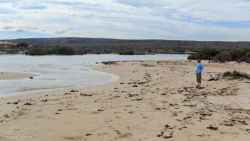
It is in WA, I first time heard of this place in a Leyland brothers doco many moons ago, more recently it was featured in a scary movie and I got to visit here last year.Leave a comment:
-
Hi Violet,
Yardie creek was open to the ocean when we were there this time last year thanks to cyclone Olwyn from memory. We had a few beautiful days camped on Ningaloo station and Yardie creek being open, meant we had to unfortunately backtrack on the drive from Ningaloo to Exmouth. Great part of the country, hopefully get back there again.
I am sure plenty of people from the forum have been here, maybe even camped here and everyone knows it name.

Leave a comment:
-
No DGW...you are exactly correct. (sorry I've been late replying). Very quick with your guess!!
In 2010 Ningaloo station recorded 135mm in 24 hours. We were camping between Yardie and Ningaloo when that happened and the rain came in less than 6 hours (mainly in about 2). A nearby numbered camping spot (in a creek bed) was 2 meters deep in water and flowing so fast you could hear it 100 meters away. The day before when we setup camp it was totally dry...we could have easily setup in the creek bed. But I (fortunately) knew better. For those that know the location, for hundreds of meters along the coast the water was like a waterfall over the 2-3 meter sea cliffs. Spectacular and a little frightening!
The photo above was about 2 days later and was still about 2-3 meters deep.
Great camping holiday with the wife in a tent! When we went back to Ningaloo a week later to move out, the station owner said that was the most rainfall they had in such a small amount of time. He also said it was almost the same about 10 years before (he did give the exact date but I can't remember). We said we knew about that because it was the LAST time we camped there. No wonder the wife doesn't want to go again!!!
Over to you DGW.Last edited by Violet; 11-05-2016, 10:30 PM.Leave a comment:
-
Sorry I've taken a while...
Here's what should be simple.
Please consider that it's 6 years old (so the area may have changed)....and there are unusual conditions photographed. Happens possibly only every 10 years or so (depending on the season)
Leave a comment:
-
You know when I've been there because all the rocks will be chucked back onto the ground where they belong. Friggin back-packers.Originally posted by Daz View PostLeave a comment:
-
You got it Violet.
On a clear day, a great view of the rivers system. Also the about the only place where you can get a mobile ph signal along GRRLeave a comment:
-
Looking out onto Cockburn Range from the other side to the Pentacost River. Sort of above the crossing. On Home Valley station.
(don't kniw why I'm answering this...I'm struggling to find an image that isn't too easy)Leave a comment:


Leave a comment: